Enjoji historic site walking
Enjoji historic site walking
Walking around the points marked on the historic site map
We had a lively walk with many participants.

Tour of historic sites at Enjoji Temple Explanation of each point on the walking course
Hongusan Enjoji was founded on the summit of Mt. Hongu, east of the roadside station, in 715 AD, about 1300 years ago. It suffered a great fire in the middle of the Kamakura period (1283 AD) and was rebuilt at its current location.
At that time, it was an whole mountain temple consisting of 14 pagodas (monk's quarters), but after its rise and fall, it now has three temples: Enjo-ji Honbo, Jizo-in (formerly Fukuzo-bo), and Io-in (former Matsumoto-bo). Of the remaining 11 temples, the location of six temples has been estimated based on place names and other factors.
It takes about 2 hours from the Furusatomura parking lot (about 1 hour for ① to ⑪), so why not visit the former site of Enjo-ji Temple in the Kamakura period?
Below is a brief explanation of each point on the walking course.
At the top of this page, there are photos of the report from the 2nd Enjoji Temple History Lecture, "Historical Site Exploration around the Enjoji Pagoda Site, etc".
-

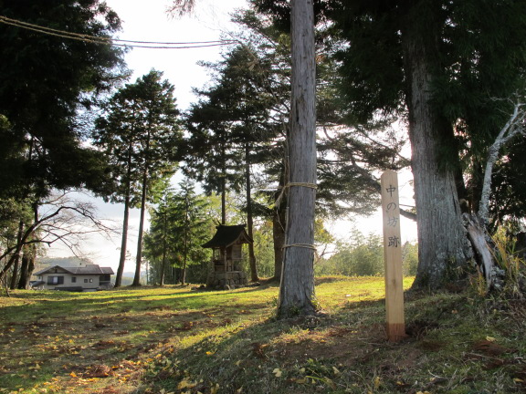
- 01 Naru no Bo Ruins
- (Current "Hurusatomura" village parking lot) The current parking lot and elementary school playground were previously fields owned by Enjoji Temple. Since this area is called Naru, it is presumed to be the site of Naru-no-bo. (Narunobou)
-

- 02 Old Matsumotobo
- (current Io-in) It is currently a Tendai sect temple whose principal image is Yakushi Nyorai. Behind the shrine are shrines such as Koshin-do and Gion-sha, all of which are presumed to have had deep connections with Enjo-ji.
-

- 03 Torakbo Ruins
- (current Tsukamoto Internal Medicine Clinic) The area near the large cedar tree, which is estimated to be 300 to 400 years old, is thought to be the site of Torakubo. It is the oldest tree in this area, along with the large cedar of Deba Shrine. (Tourakubou)
-

- 04 Enjoji Honbo
- Enjo-ji Temple, which consists of the main hall, which was rebuilt in 1846 at the end of the Edo period, as well as Amida-do Hall, Daiba-gu Shrine, Sanmon Gate, and reception hall, was once the center of Enjo-ji whole mountain Temple.
-

- 05 Kita-no Bo Ruins
- It is estimated that the site of the Kita-no-bo temple is located near the current Prefectural Treasure Hokyointo. This stone pagoda dates from the Nanbokucho period, and an estimated 5,000 unglazed Kannon and Jizo statues have been excavated from underground. (North Bo)
-

- 06 Daiba Palace
- It is dedicated to Enjo-ji Temple's guardian Daibaten, which was founded in the middle of the Kamakura period. Even today, the form of syncretism of Shinto and Buddhism (deity and Buddha are enshrined equally) still remains. (Daibagu)
-

- 07 Saizobo Ruins
- (near the current west five-ring tower) Although it was cut down in recent years, there was an old large tree that towered over this stone tower. In ancient times, Japanese people considered large trees associated with temples and shrines to be sacred, and it was customary to leave them in their place. (Saizoubou)
-

- 08 Kuragaichi Jizo
- This Jizo is estimated to have been built during the Edo period, and has no direct relationship with Enjo-ji Temple. It is a Jizo statue on the border between Enjo Village and Ueda Higashi Village in the past.
-
- 09 Nakanobo Ruins
- (near current Konpiradō) Konpiradō and Kojindo are currently enshrined on this small hill. The view from this hill retains the vestiges of the old Enjo-ji temple's temple town, and beyond that you can see the beautiful sight of Mt. Hongu.
-

- 10 Old Fukuzobo
- Currently a temple of the Tendai sect,Jizoin, whose principal image is Holy Kannon Bodhisattva. Three of the 14 temples, including Honbo and Io-in Temple, still exist, but it is said that there are not many Ilsan temples with three temples remaining.
-

- 11 Hata-no Bo Ruins
- (near the current Niban-gumi meeting hall) Behind the Niban-gumi Assembly Hall, there is a stone statue of Kojin-sama, Mori-sama, and a stone statue of unknown identity. Even after the monks' quarters were lost, their remains continue to serve as a source of worship for people in various ways.
-

- 12 Zanmai-no Rokujizo
- Zanmai is a word that means graveyard, and since there is Enjo-ji Temple's graveyard in the direction of Mt. Iwakura from Rokujizo, it is clear that this Jizo is located at the boundary between a graveyard and a human village. The "six" of Roku Jizo refers to the six paths (rokudou) of hell, hungry ghosts, beasts, asuras, humans, and heavenly beings. (Sanma no Rokujizou)
-

- 13 Marishiten of Kougeda
- Marishiten-sama was originally enshrined here, but due to certain circumstances, Kinoyama-sama and stone statues were moved from other places and enshrined there. The dense forest gives off a religious atmosphere.
Enjoji historic site map
The walking course of Enjo Furusato Village is
a trip to visit the ruins of the Tacchu (monk's quarters) of Enjoji Temple from the Kamakura period.
A diagram of the course is shown below. We apologize for the poor contrast and difficulty in viewing.
Guide maps are also available at roadside stations, Michinoeki Enjo (free of charge).
How to read the map: The right side of the map is approximately north.
The required time is approximately 2 hours for courses ① to ⑬, and approximately 1 hour for courses ① to ⑪.
